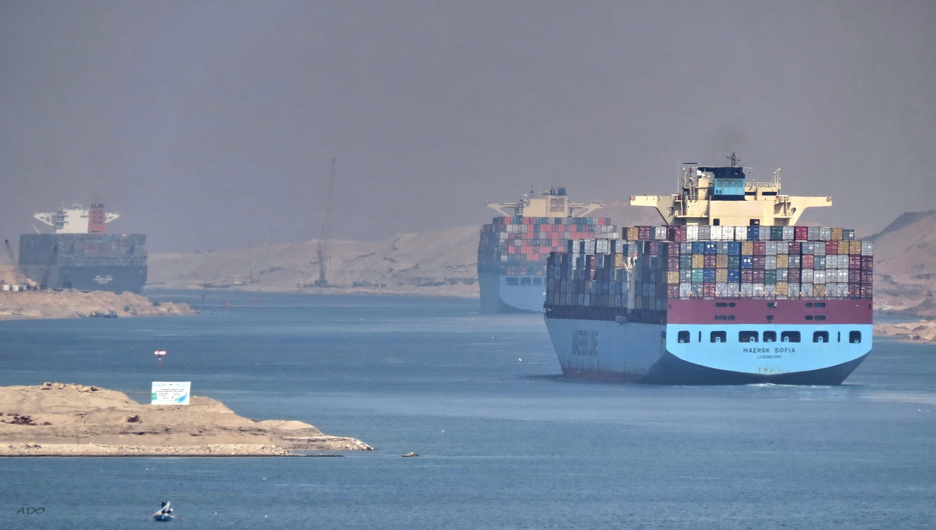
Tavelling the Suez Canal
we were in a convoy of numerous freighters and cargo ships - here the sterns of several going in the opposite direction in the only area where there is now two-way traffic.
The Suez Canal is an artificial sea-level waterway in Egypt, connecting the Mediterranean Sea to the Red Sea through the Isthmus of Suez, and separates the African continent from Asia. After 10 years of construction, it was officially opened on November 17, 1869. The canal allows ships to travel between Europe and South Asia without navigating around Africa, thereby reducing the sea voyage distance by about 7,000 kilometres (4,300 mi). It extends 193.30 km (120.11 mi) from the northern terminus of Port Said to the southern terminus of Port Tewfik at the city of Suez. In 2012, 17,225 vessels traversed the canal (47 per day).
The canal is a single-lane waterway with passing locations in the Ballah Bypass and the Great Bitter Lake.[2] It contains no locks system, with seawater flowing freely through it. In general, the canal north of the Bitter Lakes flows north in winter and south in summer. South of the lakes, the current changes with the tide at Suez. (thank you, Wiki)


archiek 14/01/2016 4:44
Excellent view of the ships traveling through the Suez Canal. Thanks for the explanation of this most important waterway.Best Regards,
Archie
SINA 13/01/2016 7:26
Very good picture AdeleNICE and fine colours
have a happy New DAY
war regards Sina
José Ramón Miguel 12/01/2016 23:37
Son tan enormes qe parecen levitar sobre las aguas y buena la atmósfera nebulosa en el entorno con ese peculiar color egipcio.Un abrazo.
Ramón
lolita cecilia 12/01/2016 22:43
Magnífica toma de lo que fué en el momento de su construcción una obra fantástica...Bravo...!!
Un abrazo, Adele
Lola
Johanna C. 12/01/2016 20:47
Good document and nice pictureBest regards, Jo
Dragomir Vukovic 12/01/2016 19:28
***Agapy 12/01/2016 17:02
Diese Durchfahrt muß ja Gänsehaut verursacht haben. Was mir jetzt witzig erscheint ist, daß ich vor kurzem im Hafen von Buenos Aires auch so ein Containerschiff mit dem Namen "Maersk Sofia" gesehen habe. Dein Bild dokumentiert jedenfalls die Situation vor Ort äußerst beeindruckend.LG Roswitha
Manfred Jochum 12/01/2016 15:17
That must be quite an exciting experience!Giampiero Mazzoleni 12/01/2016 15:13
Bellissima ripresa del Canale di Suez, brava Adele !!!ciao, Giampi
Gerrit Elshof 12/01/2016 11:10
Beeindruckendes Reisedokument.alexander stefanatos 12/01/2016 10:28
Beautiful picture,Adele. The low contrast turns the colours soft and particularly warm, especially the blue that matches nicely in three levels, sea, ships and sky. Very explicit also the information about the history of the canal which remains till our days a very important point of interest!...regards alexander
Christian Villain 12/01/2016 9:49
Une excellente pdv qui nous fait découvrir l'intense circulation des ces gros porte containers sur ce canal . La photo est d'autant plus belle que la légère brume adoucit les formes .Bravo et amitiés .
Françoise P 12/01/2016 9:42
J'aime beaucoup ces gros bateauBiz
Françoise
Markus 4 12/01/2016 8:59
ganz schoen viel VerkehrHabedieehre
Markus
Mark Billiau. 12/01/2016 8:43
Good docu shot of this famous canal !Mark